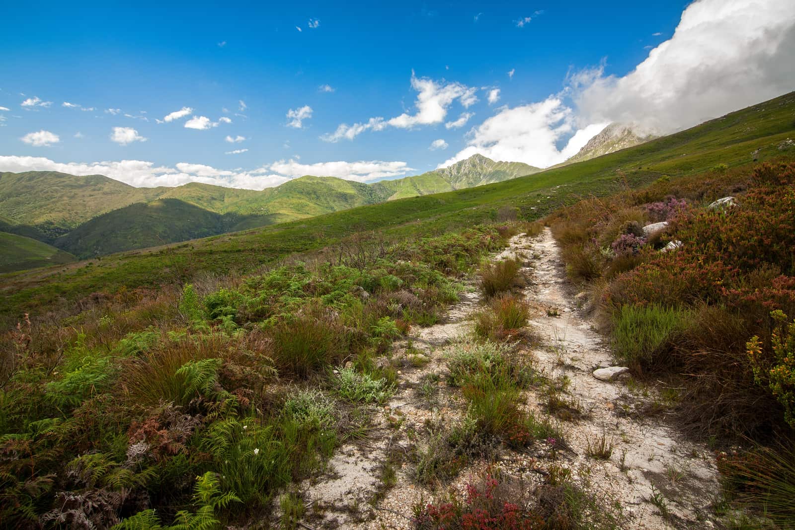
Gravel crunches under the tyres for the last kilometre and a half to the office. Then you are in the car park, the engine ticking as it cools. The slope ahead climbs in grey green and rust red, and a cloud sits on the peaks. Only the wind in the bushes.
Swellendam lies at the foot of the Langeberg, and most of those mountains are protected. Hiking here almost always means hiking in Marloth Nature Reserve, on routes from 2 to 21 km or for five days straight. Bontebok National Park, south of town, adds short, flat walks along the Breede.
Marloth Nature Reserve on the edge of town
The reserve dates from 1928. It is named after the botanist Rudolf Marloth. Covering 14,123 hectares, it protects the central Langeberg between Swellendam, Ashton, Barrydale and Suurbraak, including the Clock Peaks, the two distinctive summits above town. CapeNature lists Marloth as part of a World Heritage Site.
How far the office is from town depends on whom you ask. English Wikipedia says "about 15 km from Swellendam". CapeNature's directions give 3 km from the four-way stop in town to the gate, then another 1.4 km of gravel to the office. German Wikipedia simply says the reserve sits directly above the town.
Directions according to CapeNature: take the N2 to Swellendam and, just past town, turn left onto the R60 as far as the four-way stop. Turn right into Voortrekker Street until you see the "Marloth Nature Reserve" sign, then left into Andrew White Street and on to the gate. The office is staffed from 7 am to 4 pm. Day hikes are allowed from sunrise to sunset.
Day hikes from 2 to 21 km
CapeNature lists four day routes for Marloth with distance and time. They differ a lot. One fits into a morning, another takes the whole day and plenty of legs.
- Duiwelsbos Waterfall: 2 km, about 2 hours. Starts at the Koloniesbos car park. Wikivoyage mentions a small swimming spot at the end.
- Plaat Loop: 12 km, about 3 hours, moderate.
- Appelsbos Loop: 21 km, about 5 hours, starting at the Marloth office.
- Twaalfuurkop: 12.4 km, about 6 hours, demanding. Starts at the office, and CapeNature recommends groups of three or more. Wikivoyage puts the summit at 1,450 m.
According to Wikivoyage you can combine the Duiwelsbos walk with Koloniesbos, about 2 km and mostly in shade. That makes it the obvious choice for a hot afternoon. And with only one day in Swellendam, it still gets you into the mountains.
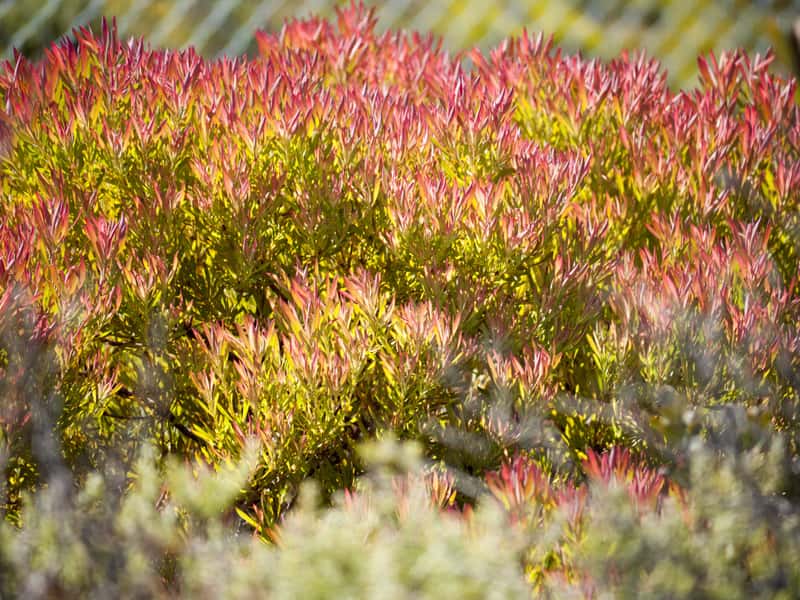
What you walk through is mountain fynbos. CapeNature names spring as the best time for flowers, with several protea species and more than 25 kinds of erica. Winters can be harsh. Snow sometimes settles on the peaks.
The Swellendam Hiking Trail: five days, four huts
CapeNature calls it the "Swellendam Multi-Day Hike". The loop starts and ends at the reserve office and crosses the Langeberg over five days. CapeNature rates it as demanding and suitable only for fit hikers. The stages according to the CapeNature leaflet (April 2024):
- Day 1: office to Boskloof Hut, 17.5 km, about 8 hours
- Day 2: Boskloof to Goedgeloof Hut, 10 km, about 7 hours
- Day 3: Goedgeloof to Proteavallei Hut, 9.5 km, about 5 hours
- Day 4: Proteavallei to Wolfkloof Hut, 8 km, about 4 hours
- Day 5: Wolfkloof back to the office, 12.5 km, about 6.5 hours
Added up, that makes 57.5 km. The same leaflet gives the total as 58.5 km. Which figure is right, the leaflet does not say.
The huts have mattresses, basic toilets and drinking water, with space for twelve people. Bring your own cooking gear. Boskloof is only a shelter with mattresses and no beds, cold in winter and hot in summer. CapeNature advises against setting off after 9 am. Every group has to attend a short briefing first, and you may not leave the path, because private land surrounds it.
- Duration
- 5 days4 nights in huts
- Distance
- 57.5 or 58.5 kmsum of stages vs. leaflet total
- Group
- 3 to 10 or 11depending on the CapeNature document
- Price
- R1,395per person per night, tariff sheet to 31 Aug 2026
- Start and finish
- Marloth officevia Andrew White Street
On group size the documents disagree. The leaflet says at least three and at most eleven people, while the 2025/26 tariff sheet and the CapeNature reserve page both cap it at ten. Plan for ten and you are safe either way.
The price according to the tariff sheet valid from 1 September 2025 to 31 August 2026: R1,395 per person per night, the same in low and high season. The reserve page says "from R1,400", undated. From September 2026 the price may differ, so have it confirmed when you book.
Book online at booking.capenature.co.za, by email to reservation.alert@capenature.co.za or by phone on 087 087 8250. For the night before you start, CapeNature rents out Bushbuck Cottage (up to four people, six at most) and Suikerbekkie Cottage (one or two people) inside the reserve. CapeNature counts all Western Cape school holidays and public holidays as high season, each including the day before and the day after.
What a day in Marloth costs
Two CapeNature figures sit side by side. According to the tariff sheet (1 September 2025 to 31 August 2026), a day hike costs R55 per adult and R35 per child. The undated reserve page, checked in October 2026, agrees. It gives the same amounts as day entry, counting children from 4 to 17, and also lists an overnight fee of R40 and R20 and a hiking permit of R50 and R30, without saying clearly what the permit covers.
Our tipThe SANParks international Wild Card covers Bontebok National Park and, according to the CapeNature tariff sheet, also the CapeNature conservation access fee. Ask when you book whether it covers the Marloth day hike in full.
Bontebok National Park trails after the flood
Down by the Breede it flattens out. Walks start at the rest camp or, for day visitors, at the old pump house. In May 2026 the flood washed away every path and viewing deck along the river. According to SANParks, as of 1 September 2026 Aloe Hill (3.3 km), Acacia (1.6 km) and Termite (about 6 km) are open again. The Bushbuck Trail (5.4 km) and the Ou Tuin Trail are still closed. Check with SANParks before you go.
Mountain bikers have the Cobra Trail, 9.2 km around Mooi Dam in the east of the park. SANParks says route information is available at reception, so ask there about conditions too. Gates, fees and the rest camp are covered under around Swellendam.
On the Breede itself, SANParks allows canoeing and kayaking inside the park, but only with your own equipment. Motorboats are not permitted.
Cycling, gravel and golf
On 1 August 2026 "Around the Pot" ran through Swellendam for the first time, a race in the UCI Gravel World Series. Riders chose between 156 and 101 km, mostly on gravel, with a crossing of the Breede. The organisers are the team behind the Cape Town Cycle Tour. No date for 2027 has been announced. Apart from the Cobra Trail in Bontebok, the CapeNature reserve at Grootvadersbosch near Heidelberg has a 6 km cycle route.
For golf there is Swellendam Golf Club. Ken Elkin laid out the 9-hole course in 1947 on the town's former airfield. It sits on a hill above town, between Marloth Nature Reserve and Hermitage Valley, with views across the Overberg. In 2026 satop100courses.com ranks it 20th among South Africa's 9-hole courses. Phone 028 514 1026.
Before you set off: weather, fire, water
In January the average daily high in Swellendam is 30.7 °C, and SANParks mentions summer peaks of around 40 °C in the park. Carry plenty of water on the long routes. On the Hiking Trail there is drinking water at the huts. In winter, snow can fall on the summits.
Fires on the Hiking Trail are tightly restricted. The CapeNature reserve page allows them only at the Glen Stream and Wolfkloof huts, while the leaflet speaks of "designated areas" and mentions a farmer who sells wood at Wolfkloof Hut. Glen Stream does not appear in the list of stages. Ask at the briefing. Heavy rain can swell the streams quickly, as it did on the Breede in May 2026.
The German Foreign Office advises hiking in groups where possible. On the Hiking Trail, CapeNature says mobile reception is only sporadic. Emergency numbers: police 10111, ambulance 10177, 112 from a mobile, Sea and Mountain Rescue 021 937 0300. Save them before you head into the mountains.
Hiking questions
How long is the Swellendam Hiking Trail?
CapeNature gives the Swellendam Hiking Trail in Marloth Nature Reserve as 58.5 km, while the daily stages in the same leaflet add up to 57.5 km. The trail takes five days with four nights in huts and starts and ends at the reserve office.
What is a short hike in Marloth Nature Reserve near Swellendam?
The shortest day walk in Marloth Nature Reserve goes to Duiwelsbos Waterfall: 2 km and about two hours according to CapeNature, starting at the Koloniesbos car park. Wikivoyage mentions a small swimming spot at the end.
Do you pay to hike in Marloth Nature Reserve?
Yes, CapeNature charges a fee per person for day hikes in Marloth Nature Reserve, with a lower rate for children aged 4 to 17. The amounts are in the CapeNature tariff sheet, so check the current sheet before you go.
Can you hike in Bontebok National Park after the flood?
After the Breede River flood of May 2026, SANParks reported that as of 1 September 2026 the Aloe Hill, Acacia and Termite trails in Bontebok National Park are open again. The Bushbuck and Ou Tuin trails are still being repaired.
Is there a golf course in Swellendam?
Swellendam Golf Club has a 9-hole course, laid out by Ken Elkin in 1947 on the town's former airfield. It sits on a hill above Swellendam between Marloth Nature Reserve and Hermitage Valley.